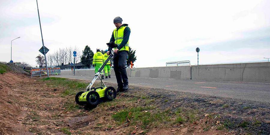
Construction crews on the Gold Coast often hit unexpected buried services or old footings mid-excavation, a mistake that can blow a budget by tens of thousands in downtime. A GPR (Ground Penetrating Radar) survey maps concrete slabs, pipes, and voids before the first digger arrives. For residential sites near the Nerang River or commercial towers in Surfers Paradise, scanning ahead eliminates guesswork. Combining GPR with a calicatas exploratorias provides ground-truth data for the most accurate picture of what lies beneath.
A single missed buried service on a Gold Coast site can cost more than the entire GPR survey, yet many builders still skip it.
Methodology and scope
Local considerations
Gold Coast’s population has grown past 700,000, and with that comes a tangle of underground utilities—fibre, gas, stormwater—installed over decades without consistent records. Striking a high-voltage cable during excavation is not just expensive; it’s a safety risk that can shut down a neighbourhood block. A comprehensive GPR survey identifies these hazards early, reducing the likelihood of accidental strikes and keeping projects on schedule. In areas with reclaimed land like Hope Island, the risk of voids or old seawalls is even higher, making pre-dig scanning a necessary step.
Applicable standards
AS 5488:2019 Classification of subsurface utility information, AS 2601:2001 Demolition of structures (referenced for site safety), AS/NZS 3000:2018 Wiring rules (for utility identification)
Associated technical services
Utility Detection & Mapping
Full grid scan of the site to locate metallic and non-metallic pipes, cables, conduits, and unknown obstructions. Deliverables include georeferenced CAD plans suitable for excavation planning.
Concrete Scanning (Slab & Wall)
High-frequency GPR scanning of concrete slabs and walls to identify rebar, post-tension cables, conduits, and voids. Ideal for core drilling or cutting in existing structures.
Typical parameters
Frequently asked questions
How deep can a GPR survey see on the Gold Coast?
In the dry sands typical of coastal Gold Coast sites, GPR can reach depths of up to 5 metres. In areas with clay or wet soils, penetration is usually limited to 1–2 metres. The team selects the antenna frequency based on your target depth.
Do I need to empty or clear the site before the survey?
Yes, the area should be free of standing water, heavy debris, and metal objects like parked cars that can interfere with the radar signal. Grass is fine, but tall vegetation should be trimmed for consistent contact.
How much does a GPR survey cost on the Gold Coast?
For a typical residential block, the cost ranges between AU$1,400 and AU$2,000 depending on the site area and complexity. Larger commercial sites requiring full grid surveys start around AU$3,500 and can go higher for multi-level scans.
What is the difference between GPR and a utility pothole?
GPR is non-invasive and scans large areas quickly, but it cannot confirm the exact material or condition of a buried pipe. Potholing (vacuum excavation) exposes the utility physically for verification. We often recommend GPR first to narrow down targets, then potholing for confirmation.